Description
MicaSense RedEdge-P Dual Multispectral Kit: Satellite-Matched 10-Band Precision for Enterprise Agriculture Programs
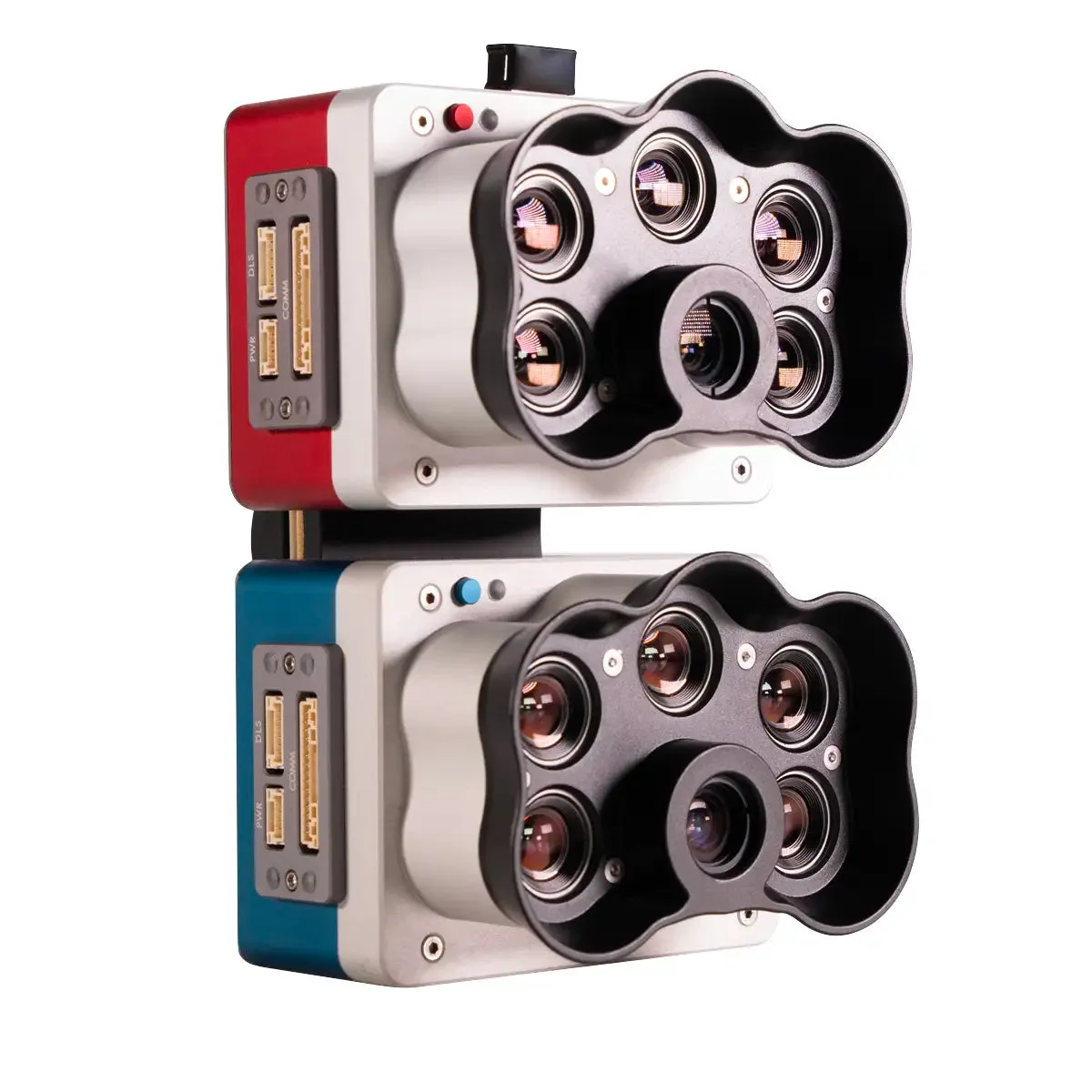
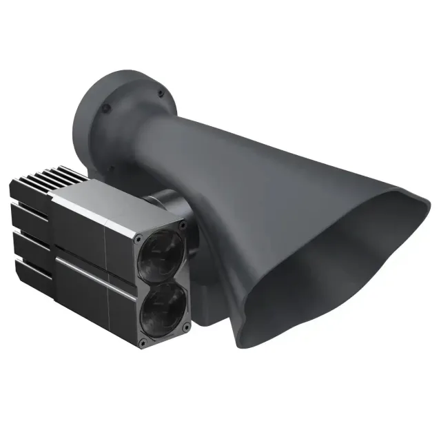
The MicaSense RedEdge-P Dual Multispectral Kit combines the RedEdge-P and RedEdge-P Blue into a synchronized dual-camera assembly that captures 10 narrowband multispectral channels and a 5.1MP panchromatic band in a single pass. Manufactured in the United States and NDAA compliant, it delivers pan-sharpened outputs at 2 cm per pixel at 60m AGL with spectral bands matched to Landsat 8 and Sentinel-2A satellites, enabling enterprise programs to correlate drone-collected indices directly with existing satellite datasets.
Key Features and Benefits
• 10-band multispectral coverage: captures coastal blue through near-IR in one synchronized pass.
• Pan-sharpened output: delivers 2 cm per pixel resolution at 60m AGL via panchromatic band.
• Coastal blue band: monitors shallow water vegetation and identifies aquatic weeds at program scale.
• Satellite-matched spectral bands: enables direct index correlation with Landsat 8 and Sentinel-2A data.
• Dual radiometric calibration: DLS2 and calibration reflectance panel maintain consistency across deployments.
• Global shutter design: all 10 lenses use global shutter for distortion-free capture across large survey areas.
• 3 images per second: synchronized 10-band capture at 3 raw DNG frames per second.
• Automatic geotagging: all 10 bands geotag automatically to streamline program-level post-processing.
• NDAA compliant: manufactured in the U.S.A. for government and institutional program procurement.
• Open data format: raw DNG output compatible with Pix4Dmapper for scalable post-processing pipelines.
At up to 3 raw DNG images per second with automatic synchronization and geotagging across all 10 bands, the RedEdge-P Dual is built for large-area coverage programs that require spectral depth, radiometric consistency, and data throughput in a single deployment. A dual radiometric calibration system using the included DLS2 downwelling light sensor and calibrated reflectance panel maintains output consistency across missions regardless of shifting illumination conditions.
The Spectral Depth That Program-Scale Analysis Requires
Five-band multispectral systems cover standard vegetation indices but leave programs without the spectral resolution needed for chlorophyll efficiency modeling, early-stage weed detection, or aquatic vegetation monitoring across large areas.
The RedEdge-P Dual addresses that gap with 10 narrowband channels, including dual red edge bands that isolate chlorophyll absorption detail a single red edge band averages out, and a coastal blue band that penetrates shallow water where standard blue channels reflect off the surface. Spectral bands are matched to Landsat 8 and Sentinel-2A, giving programs a direct bridge between drone-collected data and satellite indices already built into existing analytical pipelines.
For research institutions and enterprise agriculture programs running time-series analysis across seasons, the dual radiometric calibration system ensures that data collected in variable light remains comparable across mission dates, removing a persistent source of inconsistency in long-term monitoring programs.
Compatibility and System Integration
• DJI Matrice 300/350 series: primary recommended integration platform for the dual camera system (sold separately).
• DJI Matrice 200 series: compatible via included mounting hardware and integration cables (sold separately).
• DJI Matrice 600 series: compatible via included mounting hardware and integration cables (sold separately).
• DJI Inspire 2: compatible via included mounting hardware and integration cables (sold separately).
• DJI Matrice 100 series: compatible with DJI Z30 adapter required, not provided by MicaSense (sold separately).
• Pix4Dmapper: full dual 10-band processing support with pan-sharpening via Pix4Dfields v1.11 and later (sold separately).
• DLS2 downwelling light sensor: required for dual camera configuration, included in this kit.
• Calibrated reflectance panel: required for radiometric calibration, included in this kit.
• CFexpress card and reader: onboard storage solution for raw DNG capture, included in this kit.
• USB WiFi dongle: for camera configuration and data access, included in this kit.
Applications and Use Cases
• Precision crop monitoring programs: 10-band data supports NDVI, NDRE, OSAVI, NIT, and CIR index generation.
• Early-stage crop counting pipelines: panchromatic band enables machine learning workflows at plant-level resolution.
• Aquatic and shallow water monitoring: coastal blue band identifies submerged vegetation across irrigation and water management programs.
• Chlorophyll efficiency analysis: dual red edge bands resolve spectral distinctions that single-band systems merge.
• Long-term time-series programs: dual radiometric calibration maintains data consistency across seasonal deployments.
• Satellite data integration: spectral band alignment with Landsat 8 and Sentinel-2A supports cross-platform index validation at scale.
• Government and research programs: NDAA-compliant, U.S.-manufactured sensor with a decade-long deployment record at institutional scale.
The MicaSense RedEdge-P Dual is built for enterprise programs that require spectral depth, radiometric consistency, and spatial resolution that five-band systems cannot deliver. Its 10 synchronized bands, pan-sharpened 2 cm output, and satellite-matched spectral coverage make it the payload for programs where the data pipeline extends from the field to long-term analytical models.
Dronefly brings years of UAS industry experience to every customer relationship, with deep expertise in enterprise payload integration, multispectral data workflows, and program-level fleet support. When you source the MicaSense RedEdge-P Dual Multispectral Kit through Dronefly, you gain a solutions partner invested in the long-term performance of your precision agriculture program.
Configure your system and order today at Dronefly.
• Weight: 745 g / 26.2 oz (two sensors, mounting h Weight ardware, DLS2, and cable)
• Dimensions: 13.2 cm x 8.8 cm x 9.67 cm / 5.1 in x 3.1 in x 3.5 in
• External power: 7.0 V – 25.2 V
• Power input: 11/14.0/20W (standby, average, peak)
• Spectral bands: Coastal blue 444(28)*, Blue 475(32), Green 531(14)*, Green 560(27), Red 650(16)*, Red 668(14), Red Edge 705(10)*, Red Edge 717(12), Near-IR 740(18)*, Near-IR 842(57)
• RGB output: 5.1 MP** (global shutter, aligned with all bands)
• Sensor Resolution: 1456 x 1088 (1.6 MP per multispectral band)
• 2464 x 2056 (5.1 MP panchromatic band)
• Ground sample distance
• 7.7 cm / 3 in per pixel (per multispectral band) at 120 m / ~400 ft AGL
• 3.98 cm / 1.5 in per pixel (panchromatic band) at 120 m / ~400 ft AGL
• Capture rate: Up to 3 images per second raw DNG
• Storage: CFexpress card
• Interfaces: Three configurable GPIO: select from trigger input, PPS input, PPS output, and top of frame signals. Host virtual button. USB 2.0 port for WiFi. Serial. 10/100/1000 Ethernet.
• Field of view: 50° HFOV x 38° VFOV (multispectral), 44° HFOV x 38° VFOV (panchromatic)
• Heat: Ambient without airflow: 0-40 °C / 0-104 °F. Ambient with airflow >0.5 meter per second / >1.1 mph: 0-50 °C / 0-122 °F
• IP rating: IP4X
Reviews
There are no reviews yet.