Mission-specific sensing
Lidar mapping / surveying payload is selected for the information required by the inspection, mapping or response mission.
$24,000.00
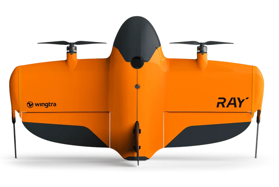
Wingtra WingtraRAY LiDAR Mapping Package is a Wingtra LiDAR mapping / surveying payload designed for 3D mapping, inspection and measurement workflows. Key model capabilities include VTOL fixed-wing mapping workflow, PPK-enabled survey accuracy. Compatibility, aircraft firmware, mounting hardware, power/data interfaces and processing software should be confirmed for the exact payload and host-aircraft configuration.
Related products, categories and research.
Wingtra WingtraRAY LiDAR Mapping Package is a Wingtra LiDAR mapping / surveying payload designed for 3D mapping, inspection and measurement workflows. Key model capabilities include VTOL fixed-wing mapping workflow, PPK-enabled survey accuracy. Compatibility, aircraft firmware, mounting hardware, power/data interfaces and processing software should be confirmed for the exact payload and host-aircraft configuration.
Enterprise UAS performance should be evaluated as a complete mission system: aircraft or payload, batteries, controller, communications, navigation, sensors, software, environmental limits, aviation permissions and data-processing workflow.
Wingtra WingtraRAY LiDAR Mapping Package is a Wingtra LiDAR mapping / surveying payload designed for 3D mapping, inspection and measurement workflows. Key model capabilities include VTOL fixed-wing mapping workflow, PPK-enabled survey accuracy. Compatibility, aircraft firmware, mounting hardware, power/data interfaces and processing software should be confirmed for the exact payload and host-aircraft configuration.
Core platform capabilities and practical deployment considerations for the named model.
Lidar mapping / surveying payload is selected for the information required by the inspection, mapping or response mission.
Mechanical mounting, power, firmware and data interfaces are designed around a compatible enterprise UAS platform.
Outputs are intended for inspection, mapping, reporting or analysis software rather than consumer-only media capture.
Where supported, aircraft positioning and metadata help georeference imagery or survey data.
Standardized payload settings and flight plans improve repeatability across recurring inspections and surveys.
Mission planning should define resolution, overlap, range, environmental limits and acceptance criteria before flight.
Representative professional use cases. Final suitability depends on the exact configuration and application requirements.
Capture detailed condition data from infrastructure, plants or difficult-to-access assets.
Create model-specific orthomosaics, point clouds or 3D outputs where the payload supports them.
Collect visual, thermal or situational data to support incident response.
Inspect facilities and process areas while reducing unnecessary personnel exposure.
Create repeatable visual records for maintenance, compliance and engineering review.
Deploy LiDAR, thermal, gas or other sensor workflows according to the named payload.
Use these model-level specifications for evaluation, then confirm the exact SKU, revision and ordered configuration before deployment.
The final quotation should make the exact configuration explicit so procurement, installation and acceptance teams are working from the same bill of materials.
Named aircraft or payload plus the model-specific standard components included in the quoted SKU.
Batteries, chargers, controller, payloads/mounts, cases, software licenses, spares and training are selected to support the expected field tempo.
Practical checks to complete before the final purchase order.
The package should be confirmed by SKU and mission: aircraft or payload, controller, batteries, charger, mounts, cases, software licenses, documentation and regional accessories can differ.
No. Endurance changes with payload, wind, temperature, altitude, battery condition, mission profile and the safety reserve required by the operator.
Commercial operation depends on the aviation rules, registration, pilot/operator requirements, airspace permissions and mission risk controls in the country where the system is used.
Only payloads supported by the aircraft’s mechanical, power, data, firmware and weight/center-of-gravity limits should be used. Confirm compatibility for the exact aircraft revision.
Plan batteries, charging, spares, communications, weather limits, checklists, firmware/software, data storage, maintenance and a documented mission-risk process.
Wingtra develops enterprise unmanned-aircraft and payload technology for professional data collection. The named payload should be procured with its required mount, firmware, software and host-aircraft compatibility confirmed.
Use the quotation stage to lock the exact model, configuration, compatibility requirements and delivery package before shipment.
Confirm the named SKU/revision and required accessories before order release.
Match the equipment to workload, facility, software and integration requirements.
Align packing, insurance, destination requirements and receiving/site readiness.
Keep the quotation, BOM and available product documentation aligned for deployment.
Explore the Drones catalogue, browse related products, or contact AI Robot Supplier for model, configuration and delivery checks. Manufacturer-level product-family information is available from Wingtra.
Send the intended use, destination and required configuration so the quotation can be matched to the real deployment.
Tell us what you need — we respond within one business day.