Description
MicaSense RedEdge-P Dual: Dual-Sensor 10-Band Multispectral Payload for Enterprise Vegetation and Environmental Programs on the SkyScout Series
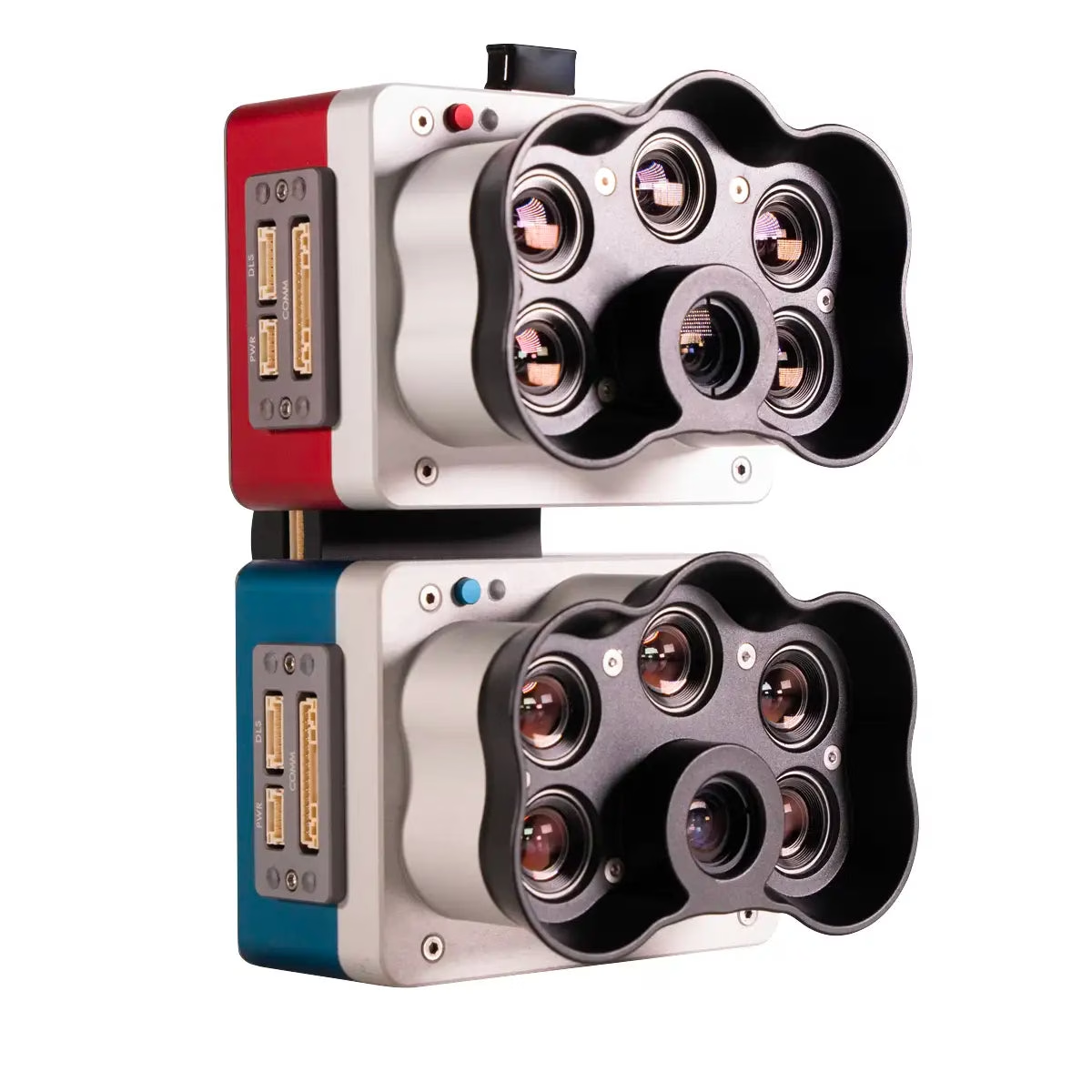
The MicaSense RedEdge-P Dual is a professional dual multispectral sensor system built by AgEagle in the USA, combining the RedEdge-P and RedEdge-P Blue cameras into a unified payload that captures 10 spectral bands simultaneously for enterprise-grade vegetation analysis, environmental monitoring, and precision agriculture programs.
Compatible with the WISPR SkyScout Series, it produces multispectral imagery across the coastal blue through near-infrared spectrum, delivering satellite-comparable spectral datasets at spatial resolutions that ground-based and orbital systems cannot match at operational cost. For fleet operators and program managers requiring reliable, calibrated multispectral data at scale, the RedEdge-P Dual provides the spectral depth and radiometric consistency that research, agriculture, and environmental programs depend on.
The payload captures 1.6 MP per multispectral band at a ground sample distance of 7.7 cm / 3 in per pixel at 120 m / 400 ft AGL, with the 5.1 MP panchromatic band achieving 3.98 cm / 1.5 in per pixel at the same altitude. Pan-sharpening technology brings spatial resolution to 2 cm / 0.8 in per pixel in post-processing.
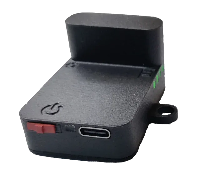
A global shutter across all 10 lenses eliminates motion distortion during flight, while double radiometric calibration through the DLS2 light sensor and CRP2 reflectance panel maintains data integrity across varying illumination conditions. All 10 bands capture synchronously with automatic triggering and geotagging, reducing flight time requirements and simplifying post-processing across large-area survey programs.
MicaSense RedEdge-P Dual Mission-Ready Capabilities
• Dual sensor architecture: two cameras deliver 10 simultaneous spectral bands per capture.
• Coastal blue band: dedicated 444nm channel enables shallow water vegetation and weed analysis.
• Pan-sharpening output: post-processing achieves 2 cm / 0.8 in per pixel spatial resolution.
• Global shutter across all 10 lenses: distortion-free capture supports accurate spatial analysis.
• Double radiometric calibration: DLS2 and CRP2 panel sustain data accuracy across light conditions.
• Panchromatic resolution: 5.1 MP band achieves 3.98 cm / 1.5 in GSD at 120 m / 400 ft AGL.
• Synchronized 10-band capture: automatic triggering and geotagging reduce post-processing complexity.
• Fast capture rate: up to 3 raw DNG images per second supports efficient large-area coverage.
• Multi-index output pipeline: generates RGB, NDVI, NDRE, OSAVI, NIT, CIR, and DSM data products.
• American-made: designed and built in the USA by AgEagle for professional program deployment.
The MicaSense RedEdge-P Dual addresses the core requirement of enterprise multispectral programs: consistent, radiometrically accurate 10-band data from a drone platform that integrates into existing SkyScout Series fleet operations.
Its synchronized capture pipeline, double calibration system, and satellite-comparable spectral coverage make it a deployable primary sensor for agriculture, environmental research, water resource management, and habitat monitoring programs that require repeatable, analysis-ready outputs across multiple flights and field conditions.
Dronefly works with enterprise operators to configure SkyScout Series payload programs around sensors that deliver production-ready data, and the MicaSense RedEdge-P Dual is a strong fit for fleets where multispectral data quality and radiometric consistency are program requirements.
The full kit includes both sensors, DLS2 light sensor, CRP2 reflectance panel, and all supporting hardware. An upgrade kit is available for programs that already operate a RedEdge-P sensor. Order now or contact Dronefly to configure your RedEdge-P Dual deployment.
General Specifications
• Weight: 745 g / 26.2 oz (two sensors, mounting hardware, DLS2, and cable)
• Dimensions: 13.2 × 8.8 × 9.67 cm (5.1 × 3.1 × 3.5 in)
• External power: 7.0–25.2 V
• Power input: 11 W standby, 14 W average, 20 W peak
• Storage: CFexpress card
• Operating temperature: 0–40°C (32–104°F) without airflow; 0–50°C (32–122°F) with airflow >0.5 m/s
• IP rating: IP4X
Spectral Bands
• 10 multispectral bands: Coastal Blue 444(28), Blue 475(32), Green 531(14), Green 560(27), Red 650(16), Red 668(14), Red Edge 705(10), Red Edge 717(12), Near-IR 740(18), Near-IR 842(57)
Camera
• RGB output: 5.1 MP (global shutter, aligned with all bands)
• Sensor resolution: 1456 × 1088 (1.6 MP per multispectral band)
• Sensor resolution: 2464 × 2056 (5.1 MP panchromatic band)
• Ground sample distance: 7.7 cm (3 in) per pixel at 120 m AGL (multispectral)
• Ground sample distance: 3.98 cm (1.5 in) per pixel at 120 m AGL (panchromatic)
• Pan-sharpened spatial resolution: 2 cm (0.8 in) per pixel
• Capture rate: Up to 3 raw DNG images per second
• Field of view: 50° HFOV × 38° VFOV (multispectral)
• Field of view: 44° HFOV × 38° VFOV (panchromatic)
Interfaces
• Three configurable GPIO ports (trigger input, PPS input, PPS output, top-of-frame signals)
• Host virtual button
• USB 2.0 port for Wi-Fi
• Serial interface
• 10/100/1000 Ethernet
Key Features
• 10 multispectral bands at 1.6 MP each
• Pan-sharpening technology for 2 cm (0.8 in) spatial resolution
• Coastal blue band for water vegetation analysis and weed identification
• Double radiometric calibration with DLS2 light sensor and CRP2 reflectance panel
• Global shutter on all 10 lenses for distortion-free image capture
• Narrow spectral bands for enhanced data accuracy
• Synchronized 10-band image capture with automatic triggering and geotagging
Reviews
There are no reviews yet.