Menu

ACSL SOTEN Survey RTK Bundle Plus with Rapid Deployment Hard Case

Original price was: $19,015.Current price is: $11,409.

• RTK module delivers centimeter-level accuracy for mapping programs
• NDAA-compliant airframe and TAITEN controller for regulated deployment
• Simultaneous RTK and camera operation from independent mounts
• Dual-band Fides-Link with AES-256 encryption for secure comms
• Five smart batteries and triple hub for extended sessions
• Wheeled hard case with custom foam for site transport
• Swappable cameras support visible, thermal, zoom, and multispectral
• Seven-inch 1500-nit TAITEN display with 8-hour runtime
• IP43-rated foldable airframe for outdoor mapping environments
• Offline maps and optional LTE for disconnected field operations

Brand ACSLSKU drn-acsl-soten-survey-rtk-bundle-plus-with-rapid-deploymentCategory ,
  • Genuine, brand-new units
  • Worldwide insured shipping
  • 12-month warranty support
  • Dedicated account manager

Description

ACSL SOTEN Survey RTK Bundle Plus with Rapid Deployment Hard Case: Integrated RTK Precision and NDAA Compliance for Enterprise Mapping Programs
Precision mapping and survey programs require a platform where positioning accuracy, data security, and deployment efficiency are built in from the start. The ACSL SOTEN Survey RTK Bundle Plus with Rapid Deployment Hard Case delivers all three in a single organized kit.
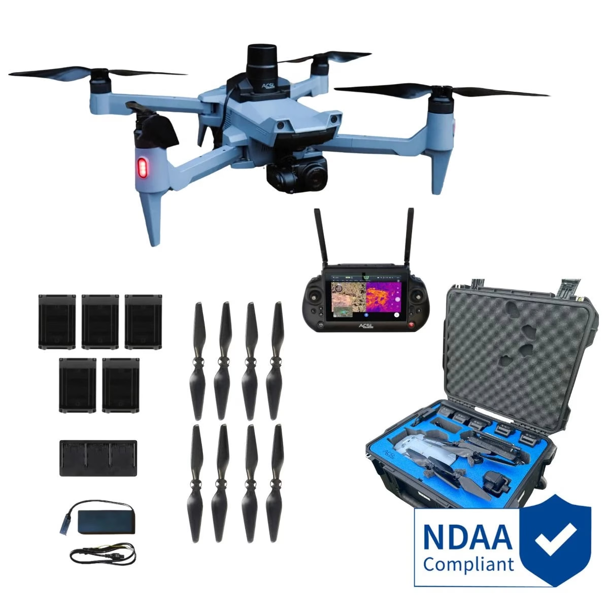
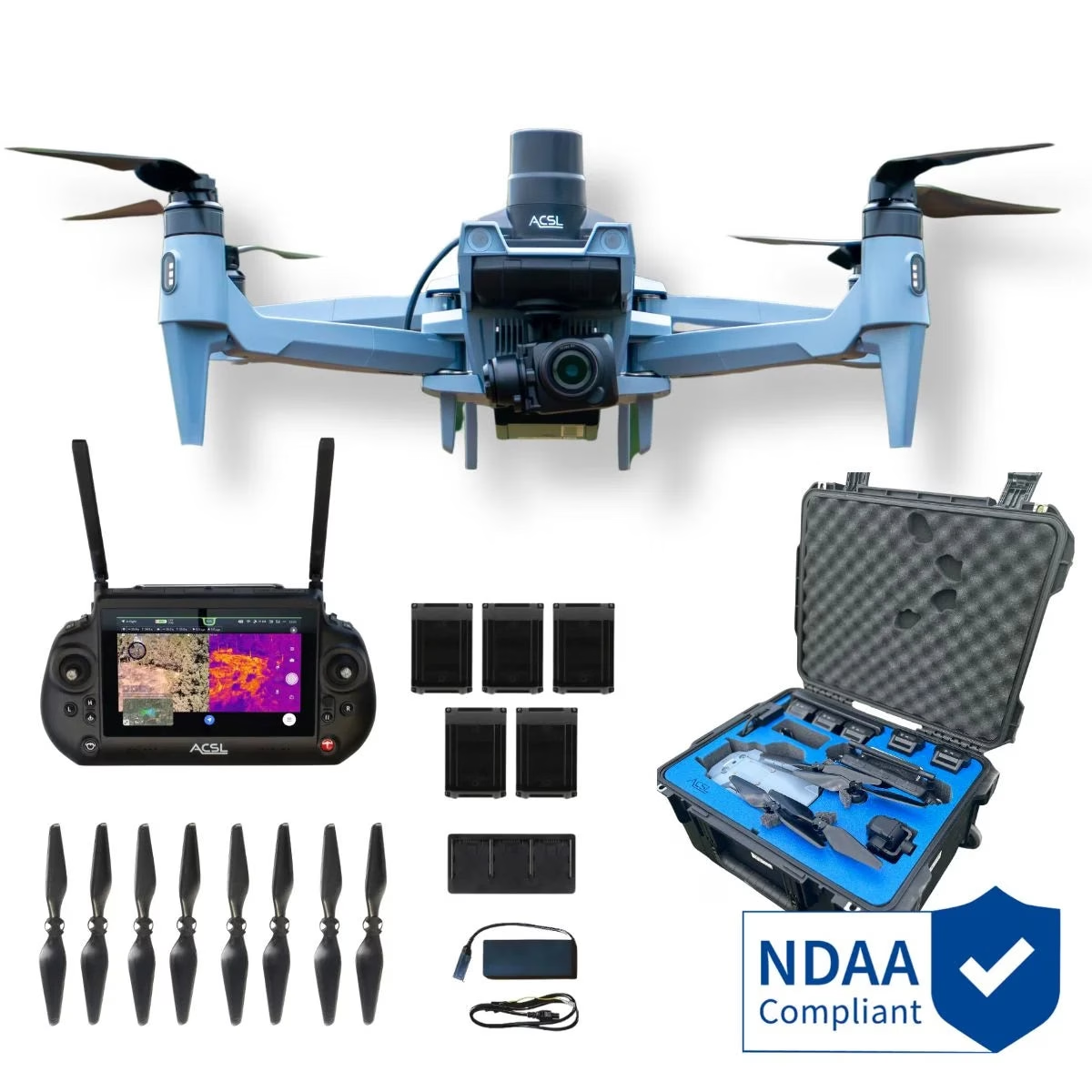
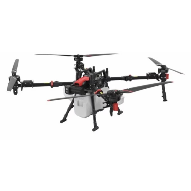
Built around Japan’s NDAA-compliant SOTEN airframe, the bundle pairs the TAITEN Smart Controller, the ACSL SOTEN RTK Module, five smart batteries, a triple charging hub, and a wheeled hard-shell case with custom blue foam interior into a ready-to-deploy survey system.
The RTK module mounts to the top of the aircraft and operates simultaneously with the bottom gimbal camera, so every flight produces georeferenced visual data without requiring hardware configuration changes between sorties.
Key Features and Benefits
• RTK positioning: centimeter-level accuracy supports survey-grade georeferencing across mapping programs.
• NDAA compliance: aircraft and TAITEN controller both satisfy federal procurement requirements.
• Simultaneous payloads: RTK module and camera operate together from independent top and bottom mounts.
• Fides-Link dual-band: 2.4 GHz and 5.8 GHz AES-256 encrypted link for resilient field communications.
• Five-battery complement: supports multi-sortie coverage sessions without returning to base for resupply.
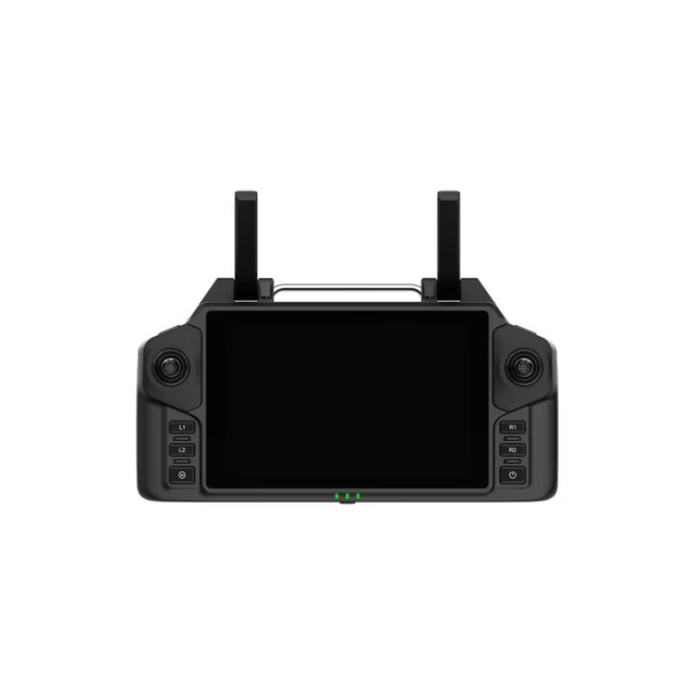
• TAITEN Smart Controller: 7-inch 1500-nit display, Android 13, and 8-hour runtime for all-day operations.
• Swappable camera system: one-touch bottom mount supports visible, thermal, zoom, and multispectral payloads.
• IP43 protection: foldable airframe withstands rain and dust across varied outdoor survey environments.
• Rapid deployment hard case: wheeled hard-shell with custom foam organizes the full bundle for site transport.
• Multi-controller support: up to three TAITEN units pair to one aircraft for structured crew configurations.
The SOTEN platform gives fleet managers a secure, compact survey tool that performs consistently across varied field environments. The IP43-rated foldable airframe, AES-256 encrypted ACSL Fides-Link communications, and ISO/IEC 15408-based security architecture support deployment in regulated and sensitive environments without additional compliance overhead.
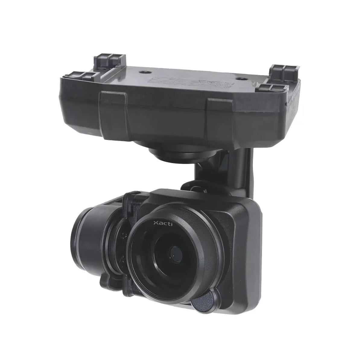
The included CX-GB100 delivers 20MP stills and 4K video at 30fps from a 1-inch sensor with mechanical shutter, stabilized by a 3-axis gimbal to within 0.02 degrees of commanded position. Combined with centimeter-level RTK positioning layered on top of the aircraft’s GPS, GLONASS, QZSS, and SLAS GNSS stack, the system produces the georeferenced datasets that mapping and survey programs depend on for terrain modeling, orthomosaic generation, and site documentation.
Survey-Grade Output from a Portable, Compliant Platform
Enterprise mapping programs need positioning data that holds up under scrutiny. The SOTEN RTK module adds centimeter-level real-time kinematic accuracy to the aircraft’s existing multi-constellation GNSS system, producing the georeferencing precision required for reliable orthomosaic generation, digital terrain modeling, and volumetric analysis.
The CX-GB100 captures consistent 20MP still geometry and 4K video across the coverage area, with a 3-axis gimbal maintaining framing accuracy to within 0.02 degrees throughout the flight. At 1,720g including camera and battery, the foldable airframe is portable enough to deploy across distributed survey sites without dedicated logistics.
With 25 minutes of flight time per battery and five batteries in the kit, program teams can plan meaningful coverage windows within a single field session. Offline map support and optional LTE connectivity through ACSL TAKEOFF keep mission execution on track regardless of site infrastructure.
Compatibility and System Integration
• CX-GB100 standard camera: included 1-inch 20MP payload with mechanical shutter and 4K capture.
• ACSL SOTEN RTK Module: included; mounts to top of aircraft, operates with camera simultaneously.
• SAMO high-resolution thermal camera: optional NDAA-compliant EO/IR payload with 640×512 Boson sensor (sold separately).
• CX-GB400 optical zoom camera: optional 2.5x optical with up to 25x combined zoom capability (sold separately).
• CX-GB300 multispectral camera: optional 1-inch 20MP payload with RGB TIFF 16-bit output (sold separately).
• ACSL TAKEOFF app: pre-installed on TAITEN for integrated flight, gimbal, and autonomous mission control.
• ACSL Fides-Link: dual-band AES-256 encrypted link with 6-plus mile unobstructed range.
• Optional LTE module: enables remote and closed-network operations for BVLOS-capable programs (sold separately).
Applications and Use Cases
• Topographic mapping: generate accurate terrain models and contour datasets from georeferenced aerial capture.
• Land surveying: support boundary, cadastral, and title survey workflows with precise aerial positioning data.
• Construction survey: document site progress and validate earthwork and grading against design specifications.
• Corridor mapping: survey roads, pipelines, and utility corridors efficiently across extended linear areas.
• Volumetric analysis: collect precise data for stockpile measurement and cut-and-fill calculations on active sites.
• Precision agriculture: produce accurate field maps to support variable-rate application and agronomic planning.
• Infrastructure inspection: combine RTK-accurate positioning with visual capture for georeferenced asset records.
• Environmental monitoring: conduct repeatable aerial surveys with consistent georeferencing for change detection.
The ACSL SOTEN Survey RTK Bundle Plus with Rapid Deployment Hard Case is the right starting point for enterprise programs that require survey-grade positioning, visual data quality, and compliance in a single deployable kit. The RTK module, CX-GB100 camera, five batteries, and full support equipment ship together in a wheeled hard-shell case that moves from vehicle to launch point in a single trip.
For fleet integrators and program managers building precision mapping workflows around a secure, portable, and NDAA-compliant platform, this bundle delivers the foundation to operate at that standard from day one.
Dronefly has built its reputation on matching the right UAS platform to the programs that depend on them. As a premier West Coast UAV dealer with deep experience across mapping, survey, and precision data collection verticals, Dronefly provides the application knowledge and integration support your team needs to deploy the SOTEN Survey RTK Bundle with confidence.
Buy the ACSL SOTEN Survey RTK Bundle Plus today at Dronefly and start collecting survey-grade data on your next flight.

Aircraft
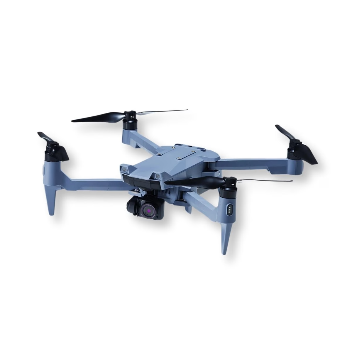
• Form factor: Compact, foldable quadrotor
• Dimensions (unfolded): 637mm × 560mm (including propellers)
• Dimensions (folded): 162mm × 363mm
• Height (unfolded): 153mm (including propellers)
• Weight: 1,720g (including standard camera and battery)
• Max takeoff weight: 2,000g
• Rotors: 4
• IP rating: IP43 (with camera, gimbal, and battery installed)
• Operating temperature: 0°C to 40°C (32°F to 104°F)
• Operational altitude limit: 2,000m (6,562 ft)
• Max speed (no wind): 15 m/s (33 mph)
• Max ascent speed: 3 m/s
• Max descent speed: 2 m/s
• Max pitch angle: 30°
• Angular velocity: Pitch 80°/s, Yaw 45°/s
• Max flight time: 25 min (with standard camera, 8 m/s wind); 29 min (without camera, 8 m/s wind)
• Operating frequency: 2.412–2.477 GHz (aircraft radio); dual-band 2.4 GHz + 5.8 GHz via TAITEN/Fides-Link
• GNSS: GPS + QZSS + GLONASS + SLAS (Michibiki sub-meter augmentation)
• Hovering accuracy (vision positioning): Vertical ±0.1m, Horizontal ±0.3m
• Hovering accuracy (GNSS): Vertical ±0.5m, Horizontal ±1.5m
• Security architecture: Based on ISO/IEC 15408 principles; AES-256 encrypted communications; optional in-flight data encryption on media; optional Japanese cloud data management
• NDAA compliance: Yes (aircraft)
• Remote ID: Compliant
• DIU Blue UAS: Not currently listed
• LTE: Optional module for remote/BVLOS operations and closed-network control
• Offline maps: Supported via ACSL TAKEOFF app
• Multi-controller support: Up to 3 controllers per aircraft (instructor/payload/handoff)
• Country of manufacture: Japan (major parts domestic or from highly reliable overseas sources)
Vision / Obstacle Avoidance System
• Forward obstacle detection range: 10m
• Up obstacle detection range: 5m
• Down obstacle detection range: 5m
• Detection angle: 70° horizontal, 40° vertical
• Detection frequency: 10 Hz (forward, up, down)
• Operating environment: Adequate lighting and clear texture required
Infrared Sensor (obstacle avoidance)
• Up detection range: 2m
• Down detection range: 12m
• Up detection angle: 27°
• Down detection angle: 2°
• Detection frequency: Up 50 Hz, Down 50 Hz
• Operating environment: Large, diffuse, or reflective obstacles
Standard Camera — CX-GB100
• Sensor size: 1-inch
• Effective pixels: 20 megapixels
• Shutter: Mechanical
• Still image formats: JPEG / DNG / JPEG+DNG
• Still image resolution options: 20MP / 15MP / 10MP
• Compression: Superfine / Fine / Normal
• Video formats: MOV / H.264
• Video quality: 4K 30fps; 2.7K 60/30fps; Full HD 120/60/30fps; HD 60/30fps; nHD 240/120/60/30fps
• Video recording time: Up to 60 min; auto-split options
• Recording media: microSD, UHS U3 or V30 / Video V30
• Focus modes: Single AF / Continuous AF / MF; Multi AF / Spot AF area
• Exposure compensation: -2EV to +2EV (1/3EV steps)
• Data encryption: Optional; can be enabled/disabled on recording media
Camera Gimbal
• Axes: 3-axis
• Pan range: ±85°
• Tilt range: -115° to +45°
• Max speed: Pan 60°/s; Tilt and Roll 100°/s
• Control accuracy: ±0.02°
• Switching method: One-touch camera switching (drone can remain powered on)
TAITEN Smart Controller
• Display: 7-inch, 1200×1920 resolution, 1500 nits brightness (daylight readable)
• Operating system: Android 13
• App: ACSL TAKEOFF (pre-installed)
• Link system: ACSL Fides-Link
• Operating bands: Dual-band 2.4 GHz + 5.8 GHz
• Encryption: AES-256
• Range: 6+ miles / ~10 km (unobstructed, low interference; varies with regulations and environment)
• Wi-Fi: Supported
• Runtime: Up to 8 hours
• Power: USB-C charging and power input
• IP rating: IP54
• Operating temp: -20°C to 60°C (-4°F to 140°F)
• Storage temp: -20°C to 50°C (-4°F to 122°F)
• Charging temp: 0°C to 45°C (32°F to 113°F)
• Multi-controller pairing: Up to 3 controllers per aircraft
• Controls: 2-axis sticks; 2× gimbal wheels; 3-state mode switch (AUT/POS/MAN); Go-Home, Land, Emergency, Power buttons
• Customizable inputs: 3-state switch, 8 buttons, 2 wheels, 5-way hat
• I/O: HDMI out, USB-C, USB-A 2.0, microSD, Ethernet, 3.5mm audio, tripod mount
• Sensors: GNSS module, ambient light sensor (auto-brightness), microphone, vibration motor, connection LED, battery LED
• Physical: Approx. 10.6 × 6.5 × 2.7 in; ~3.2 lb (~1.45 kg)
• NDAA compliance: Yes
• Remote ID: Compliant
Battery
• Type: Lithium-ion
• Capacity: 94 Wh
• Quantity in bundle: 5 smart batteries
Compliance Summary
• NDAA: Yes (aircraft + TAITEN controller)
• Remote ID: Compliant
• DIU Blue UAS: Not currently listed
• Link security: AES-256 via ACSL Fides-Link, dual-band
RTK Module
• Adds real-time kinematic (RTK) positioning to the ACSL SOTEN drone
• Delivers centimeter-level positioning accuracy
• Mounts to the top of the SOTEN aircraft
• Requires no additional hardware or complex setup for integration
• Part of SOTEN’s modular payload ecosystem
• Only one payload can be attached to the SOTEN at a time

Additional information

Brand

ACSL

Reviews

There are no reviews yet.

Be the first to review “ACSL SOTEN Survey RTK Bundle Plus with Rapid Deployment Hard Case”

Your email address will not be published. Required fields are marked *

Recently viewed